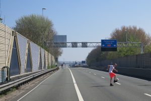
The fact that I moved to Bos en Lommerplein in Amsterdam eight years ago had many reasons: limited financial resources, curiosity about an ‘immigrant’ (a politically correct term at the time) neighbourhood, but also its location at an infrastructural junction. Everything is close at hand here: tram and bus (30 m) underground (500 m), train (1,300 m) and the approach road to the A10 highway (80 m). The iconic Max Havelaar Flat – which is almost on the highway and images of which frequently show up during protests against environmental pollution or in studies on highways and urbanization – is located right around the corner.
I must admit I am partial to highways. I have been writing reports and reviews about them for more than 20 years. They are not pretty, but that’s no reason to neglect them: we spend a lot of time on them and they determine our conception of our country to a large extent. They are as real as the city, to which we pay much more attention. But my love for the highway did take a blow in Bos en Lommer. After living there for a while, I discovered that particulate matter is not just an abstract, insidious danger to public health, but that you can see it as well. Again and again, the car’s emissions drift down to cling blackly to the railing of my balcony.
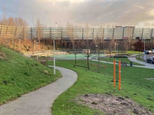
So here in Bos en Lommer, the worlds of city and highway literally meet. Here, unsurprisingly, efforts to heal the wounds the highway struck in the 1960s have also been ongoing for a long time. In 2004, buildings were constructed on either side of the flyover that takes Bos en Lommerweg across the A10. Not a brilliant idea nor brilliant architecture, but it works like a charm: cyclists and pedestrians that want to go from the western half of Bos en Lommer to the market and the shops on the eastern side are not only physically sheltered by the buildings but more importantly, the gap has also been closed visually: you no longer feel like you have to cross the highway to go shopping. The fact that authorities already managed to tame this highway 12 years ago is primarily due to the political-administrative setup of the time. The A10 is not only an urban boundary; it is administratively a hard limit, except where it cuts across Bos en Lommer, located on either side of the highway and still an independent city district at that time. That the bridge buildings were actually realized was partly due to the pushing and shoving of district councillor Hans Luiten. The northern part stood empty for a long time and housed a squatted mosque until district West itself, comprising the merged former Bos en Lommer, De Baarsjes Oud-West and Westerpark areas, itself moved into the property in 2010.
The silver-coloured buildings are not easy to overlook, but the shrewd observer will also see an unintentional example of integration of city and highway. From the flyover, a tile path leads along the highway approach road to the south. This is not completely legal – you just have to ignore the prohibition sign for pedestrians – but this way, you can simply walk to the back entrance of the GAK, an 11-floor office building designed by architect Ben Merkelbach that was recently transformed to accommodate more than 500 studios. For years, I’ve been expecting the imminent removal of the footpath, but the gap between the worlds of Rijkswaterstaat and that of the city administration sometimes has benefits as well, in any case, the footpath is still there.
Though Bos en Lommer was not a location in the ‘Highway and City’ research by design the intersection of A10 and Lelylaan, which is located two approach roads to the south, was included. Nevertheless, I decide to visit this location last during my tour of the five locations: I will first visit both of the Rotterdam locations, than go to Utrecht and conclude with the ones in Amsterdam. A 186-km round trip on what you might call, a bit arbitrary, the Randstad ring road; a ring road besieged on all sides by the advancing city and one that therefore houses many locations that the research by design at hand can sink its teeth into.
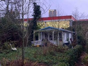
Take, right at the very beginning, the stretch between Amsterdam and Halfweg. Though it is not a real highway, the two-lane motorway is an almost equally strong barrier. For the housing projected in the moribund office location Sloterdijk to bridge the gap to the Sloterdijk neighbourhood to stand a chance, the maximum speed must be reduced. But before that stage is reached, hotels will take the lead: late last year, a long-vacant office building located at a 36-m distance from the highway was transformed into the Urban Lodge Hotel; a year earlier the Teleport Hotel opened its doors at a 48-m distance from the highway. Since no people live there, sound walls are not necessary and therefore they are so close to the highway you can almost touch them from your car.
Simple interventions like these are not possible in the Rotterdam district Overschie along the A13. As in Bos and Lommer, a busy highway has intersected this residential area for decades. In the late 1990s, I attended a neighbourhood meeting held here in response to a report of the Rotterdam GGD that showed how people that live close to the highway run health risks as big as those of people that are subjected to the passive smoking of 16 cigarettes per day. In an attempt to force the Ministry of Housing, Spatial Planning and the Environment to reduce the traffic volume, housing association WBR announced it would not spend another penny on the maintenance of the 900 dwellings within the ‘red zone’.
That was almost two decades ago: the A4 has been extended and the sound barriers raised spectacularly, but essentially nothing has changed. The Mecanoo team, which focused on this location, concluded that the Noise Pollution Act blocks the replacement of outdated social housing, resulting in a lot of money being spent on the maintenance of uneconomical dwellings. Once the bypass A13/A16 is completed, traffic volumes will decrease, but the A13 will remain one of the main entrances to Rotterdam. And this is why team Mecanoo advocates structural measures: tear down the dwellings directly adjacent to either side of the highway and replace them by a highway park with water basins, ecological zones and cross connections for slow traffic. Around 2030, when expectations say the self-driving electric car will have been introduced good and proper, the sound walls can be removed and building in the park area incrementally allowed.
Driving through the streets of Overschie, I am trying to imagine this future when I see a big metal box standing on a trailer on Parallelweg-Oost, an oversized periscope extending above the sound wall. ‘We Clean Your Air’ it says; a man is working a laptop to one side. ‘It’s an experiment commissioned by the municipality of Rotterdam,’ he says and introduces himself as Hans de Haar from the company Environmental Nano Solutions, ‘we’re examining possibilities to clear the air of particulate matter’. Something like Daan Roosegaarde’s Smog Free Tower? ‘We work the technical side of his tower, but Daan sometimes forgets to mention us.’
De Haar actually got the idea to purify the air by chance. The installation he placed in a parking garage beneath a shopping centre in Cuyk in 2014 not only kept the air inside the garage itself clean, but people living in nearby apartments told him their white garden chairs took longer to turn black than before as well. Research by Eindhoven University of Technology shows that parking garages can become ‘the lungs of the city’.
De Haar opens the box to show me the black deposit that is precipitated on the contraption: ‘Ionized particulate matter.’ If the results of this test are positive, he wants to develop sounds walls with built-in extractor systems. ‘This is very necessary, because though there is much ado about electric cars, they will not solve the problems caused by particulate matter and noise.’ That is because in the city, 97 per cent of all particulate matter emissions are produced by the deterioration of tires, breaks and the road itself.
When I drive on, I realize that De Haar has given me a warning rather than hope – after all, his is only an experiment. Many of the promising projects of architects and urban planners that have appeared in recent years blindly assume that technology will simply solve the city’s environmental problems and that soon we will therefore be able to build close to the highway. Team Mecanoo has managed to avoid this pitfall – at least for the period until 2030 – and their park is concrete and will help in the short term.
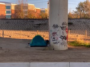
On Kleinpolderplein, I fight down an impulse to drive the lap I once plotted for highway aficionados and that leads across all of the four levels of the Netherlands’ most metropolitan infrastructure node. Duty is calling, in this case the eastbound A20. Wim Nijenhuis and Wilfried van Winden’s marvellous highway book De diabolische snelweg (The Diabolical Highway) took both its title and its cover from this highway. They also describe the world adjacent to and underneath the highway, ‘a useless three-dimensional sound barrier zone’, ‘a true shadow world’ with ‘caves, basements and sewer pipes’, in which people ‘perform informal and especially slow actions, such as walking their dogs’.
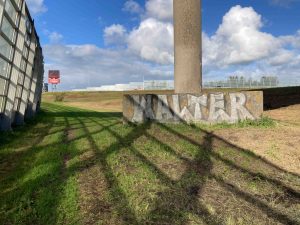
It is a mess down there indeed, a series of residual spaces, fences, a pony yard, ditches, a caravan storage yard, conifer-lined allotments, warehouses, sheds. It’s a place that doesn’t seem to belong to anyone. Both of the A20 teams took a close look at this messy residual zone.
Team Mauroparravicini combines it with the rest of the diamond-shaped ring road around Rotterdam and wants to make the 40-km-long no-man’s land accessible to local residents. Overhauling and connecting all of the green and blue residual spaces creates a string of public places, a recreation zone along and underneath the highway. Rather than the A20 itself, the parallel Gordelweg obstructs such plans at this time. Upgrading the A20 would allow the removal of this parallel road and – for example – the creation of a ‘sub highway park’ by planting the now fenced off, sad retention canal area underneath the A20 with water plants that require little daylight. The neglected station Rotterdam-Noord is livened up with a bar, nightclub and studios.
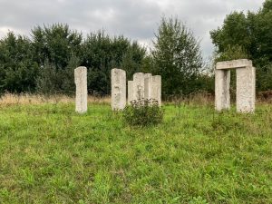
After analysis, the Mauroparravicini team decided to go for architectural and urban planning interventions; team Bijvoet on the other hand kept its toolbox closed and focused on further research: what sort of things exactly can be found at the foot of the highway: animals, fences, Old Timers, plants, petrol stations, summer houses, works of art, sports fields and so on. Totalling all of the green fragments, they measured a roadside landscape of 937,000 m2, which is almost half the size of Rotterdam’s Zuiderpark, the largest park in the Netherlands. They published all of their discoveries in an atlas, which they then translated into a treasure map. ‘The knobs and functions are visible. But who is going to turn them?’, they wonder, somewhat melodramatically.
The map almost did not make it into the book, because the designers felt it was a bit too detailed, that they would rather sketch their story in broad outlines and focus on the importance of hospitality to the transformation of the current cluttered zone into a national waterway park. But the local department of Rijkswaterstaat was immediately enthusiastic about the treasure map and the opportunities it offers to flesh out maintenance planned over the coming five to ten years and it therefore nevertheless prominently graces page in the book. Perhaps the municipality of Rotterdam ought to make Rijkswaterstaat responsible for the development of this area; that would at least produce an original host.
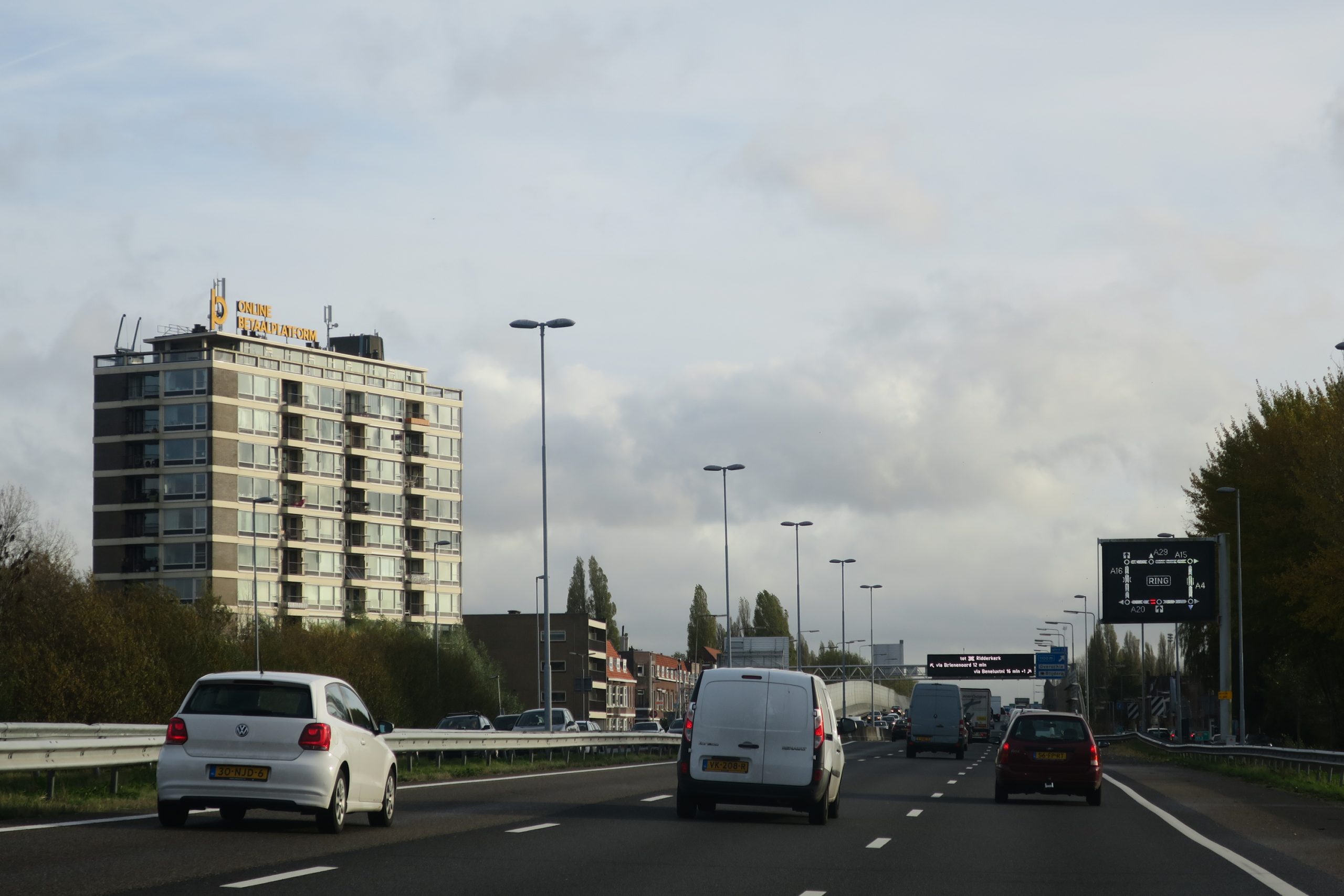
Rotterdam is not all that easy to leave. The route is not the problem – the highway simply runs straight on – but there is just no end to the buildings. Offices, sound barriers, industrial estates, a work of art that marks the lowest point of the Netherlands, sheds, an aqueduct with an bridge across the water (under construction) beside it, two hotels, kitchen centres . . . only at Bodegraven do you finally catch a glimpse of the famous Green Heart. I have driven more than 100 km and only now do I see polders, grass, cows, a small dike, the horizon. But not for long, the advancing city resurfaces near Woerden.
A highway attracts buildings; there is no cure for that. It is just that you hardly notice their arrival: they creep up on you and once things have changed, you can hardly remember what they used to be like. So it goes with shop windows, fashion, aging and so it goes with highways. Fortunately, Francine Houben, as curator of the first International Architecture Biennale Rotterdam, which was about mobility, ordered the filming of a tour of the Randstad. Using the car as a room with a view, four cameras recorded the view from the highway in 2003. It is a benchmark film and really one that ought to be remade now, 13 years later, to see what is now gone and especially to see what has been added since.
But it is clear even without such an objective comparison that the highway has become more busy, broad and crowded. Earlier that day I drove through the blue-and-white checked aqueduct underneath the Ringvaart of the Haarlemmermeer polder: until 2010 this was broad enough for the entire A4, today only traffic due south uses it; the north-bound traffic has a completely new aqueduct at its disposal. A bit further on lies the Leiderdorp Furniture Strip that was built directly adjacent to the highway in the second half of the 2000s and that Adriaan Geuze used to illustrate the collapse of spatial planning in the TV show Zomergasten: ‘Who commissioned this?’
The city is intensely involved in highway matters, for example by building train stations alongside them like the one I passed in Halfweg. Highway signs indicating P+Rs and numbers of available parking spaces are booming – and they work: I made the rounds on a weekday in November and a strikingly large number of parking garages were full. Barriers or sound walls are also popular locations for billboards offering houses or lots for sale – ‘Are you looking for a 010-lot?’ ‘Yes please, near the A20.’
Cities increasingly use the highway as part of their own traffic system and the designation ‘Ring Road’ is found more and more often. The Hague, which the A4 actually only gently grazes, has managed to convince the ANWB to put ‘Ring A4’ on the signs between exit road 8 and exit road 12.
Utrecht Science Park (USP), the largest campus of the Netherlands, is located at the intersection of the A27 and the A28. Still, it is not an easy-to-find kind of place and this is not only due to the fact that it is called ‘De Uithof’ on the highway signs. Like The Hague, Utrecht does not really have a ring road, but at least the latter is bounded by highways on three sides. They cater to through traffic especially; parallel lanes cater to local traffic and those who fail to notice this in time are carried towards the German Oberhausen.
There is no exit road from the A27 to USP: you have to drive past the campus, take the A28 and then take the first exit road, which will take you straight to the brand-new multimodal parking garage. I drive up sloping parking decks until I reach the eleventh floor – the view is phenomenal. The green campus at your feet, Het Gooi to the north, the Utrechtse Heuvelrug National Park to the east, and to the west the city of Utrecht with the Dom Church and the new, sparkling-white city hall near the station.
But the view meant nothing to the builders; this parking garage is the newest asset in the battle for USP’s accessibility. You park your car here, take the lift down to the ground floor and travel to either the campus or to the city centre of Utrecht by public transport – using double-articulated buses at this time, soon by tram. Most of the rails are already in place; the Uithof Line will be operational from 2018.
Team Venhoeven thinks that though this is an improvement, it will not be enough: the tram line will reach its maximum capacity in a mere 12 years. And so more drastic measures are needed: a light rail from Woerden via Utrecht-Oost to Amersfoort has to relieve Utrecht Central Station and simultaneously create a new public transport node on the east side of the city. This new station – which naturally includes a P+R – is not only built for the benefit of USP, but emphatically serves Rijnsweerd and the rest of eastern Utrecht as well. At this time, it is still a non-descript transition zone, but turning it into a slow-traffic boulevard at a right angle to the A27, will make it an attractive area with shops, hospitality businesses and other amenities will encourage its development into the new campus core.
Team Benthem Crouwel Architects also enters into combat with the monofunctionality of the area and focuses on the creation of a boulevard for slow traffic, but where team Venhoeven picks public transport as the means of transport and the Archimedeslaan as a central axis, team Benthem Crouwel Architects picks the bicycle and the inner ring, called Waterlinieweg. After all, the bicycle is increasingly being replaced by the E-bike and this will increase the range of cyclists considerably. The inner ring that is currently the exclusive domain of the car is to become the ‘robust backbone of a highly urban environment’. The Weg tot de Wetenschap – which connects Waterlinieweg with USP – will be overhauled as well: the underpass beneath the A27 is opened up radically, creating a large, inviting entrance square with sports facilities.
Both plans sound attractive: do we really have to choose? A combination of public transport and bicycle makes sense, just like one of Waterlinieweg, Archimedeslaan and Weg tot de Wetenschap. Utrecht will welcome more than 65,000 new residents in the next 20 years (that is plus 20 per cent), so the demand for housing and facilities seems big enough to warrant adding a new urban core to the city. This would furthermore lift some of the immense pressure that is now on Utrecht’s medieval city centre.
I drive down 11 floors, turn onto the A27 and continue my rounds. Though the Amsterdam-Utrecht region has the highest growth rates of the country, I am soon surrounded by green once more. Near the intersection with the new railway bridge to Almere, a road-side ANWB sign announces that there is not only petrol to be had in about 1 km, but information about Amsterdam as well. However, at De Hackelaar, the petrol station that famously lent its name to a criminal, they profess ignorance. Even the city map that once adorned the walls of all petrol stations is nowhere to be seen. Though the city is increasingly involved in highway matters, the interest is not mutual. Even though Amsterdam is only 5.5 km further down the highway, it is still a completely different world.
Gooiseweg – the S112 in highway speak – is also hardly noticeable from the highway, though the canal you cross catches the eye, a cluster of towers near Amstel station on its horizon. And yet this is a major intersection, Gooiseweg is a motorway with flyover junctions. In the 1960s, the plan was to have it connect Amstel Station to ‘Gooistad’, but it was never extended beyond the A9, which runs straight through Amsterdam-Zuidoost. This road is gradually losing its significance; at the tail end, in the Bijlmer, it has already been lowered or narrowed in a couple of locations. On the side of the city, however, it is still at full post-war-car era strength, a kind of super Wibautstraat.
Here, the city limits are as incomprehensible as the road is clear and straightforward. The stretch from the A10 to the northwest is unambiguous: there, Gooiseweg is on Amsterdam territory. But driving to the southeast, you find yourself in the municipality of Ouder-Amstel for 400 m; next you are in the municipality of Diemen for 750 m and finally you are back in Amsterdam. It does not make the urban planning in this area any easier.
The NEXT team drastically ends the dominance of the car: not only Gooiseweg becomes a city boulevard – with a tram to Amsterdam-Zuidoost – but so does part of the A10 itself. Not that the team expects car traffic to decrease to the extent that the highway is no longer necessary: between exit roads 112 and 113, the A10 is simply tunnelled. Left aboveground is a boulevard for local traffic that runs parallel to Weespertrekvaart – this lured the designers into the use of the pun ‘Boulevaart’ – the ‘vard’ of ‘boulevard’ is replaced by the ‘vaart’ of ‘Weesterpertrekvaart’, which means ‘canal’.
The reorganization of the infrastructure does not stop there: to enable new urban development along the ring road, the team designed a fine-meshed framework of streets with staggered road profiles and ‘mediating buildings’ that absorbs the height differences. Ordinary streets with housing on them: that would finally result in good and socially safe slow traffic connections between Amsterdam and the Bijlmer.
Team NEXT doesn’t address the issue, but it is a shame to limit this strategy to the Gooiseweg area: connections for pedestrians and cyclists are awful all over Amsterdam’s southeast flank. Here, the municipalities of Amsterdam, Ouder-Amstel and Diemen have been evolving back to back for decades and the result is a wide strip of residual zones, industrial sites and storage spaces. Yes, they are transversed by a couple of red asphalt ribbons for cyclists, but after dark these are hardly used at all.
Only 9.5 km to go to the last location, Cornelis Lelylaan. This is also a city motorway with flyover junctions that leads out of Amsterdam from the city centre, another relic of the unbridled separation of functions, another road that was supposed to be a lot longer and that has been partly lowered in the course of time. This is Gooiseweg’s younger brother; there is only a year between them.
Amsterdam’s urban planners have been shortlisting this area as a densification location for years: there is plenty of room and the area is easily accessible, with a highway approach road and, 500 m further on, a subway and train station. This year, things are beginning to make progress: two towers with a total of 590 student units and 279 dwellings for young professionals are springing up near the station. The first tower has already reached its highest point; the second will do so early 2017. Still, they do not exactly fill the gap around the A10.
The most spectacular-looking plan by far is the one the UNStudio team made for the project ‘Highway and City’: it places a brilliant-white, upward-spiralling hub on top of the highway flyover. It is projected as the link between the city and the highway: you can park your car there and change to self-driving public transport into the city; conversely, the residents of Amsterdam can pick up a shared car here to leave the city. The hubs – of which there are to be a total of 11 on the A10, including one on the exit road to Gooiseweg – will also function as power plants thanks to the storage of energy in the batteries of parked cars and will contain shops and hospitality industry as well.
Rather less striking but perhaps more interesting is the simultaneous addition of new housing to the area. A volume study shows that there is room for a total of 8,400 dwellings on either side of Lelylaan and A10. The densification proposals in this study are as pragmatic as the hub looks futuristic. The existing apartment buildings on the inside of the A10, for example, are embedded in blocks of six-storey buildings.
This will undoubtedly encounter protests from the Vereniging Vrienden van het Rembrandtpark (Friends of the Rembrandt Park Association), which defends every square metre of green by tooth and nail, but it would finally provide the 1970s blocks, now raised on blind, two-storey plinths, with a view of the ground level. This would not only make the park more vibrant and safe, but also and especially bridge the distance to Overtoomse Veld, the neighbourhood on the other side of the A10.
According to UNStudio, this urban densification operation requires just over 2.5 billion euros, that is 3,400 euros per square metre. These are current prices for Amsterdam. Perhaps it is early days yet for the hub, but you could start building those houses tomorrow. Unfortunately, the sound barriers would have to stay for the time being, because the noise and particulate matter problems still await solutions.